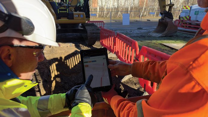
The latest digital mapping innovation is being implemented on projects delivered through the Repairs and Maintenance Framework with Northumbrian Water Group.
The National Underground Asset Register (NUAR) was created by the Geospatial Commission to digitally map data on underground power cables and utility services across the UK.
Clive Surman-Wells, Innovation Partnerships Manager at Northumbrian Water Group, initiated the concept during the firm’s Innovation Festival in 2018.
He said: “We’re convinced of the many benefits of NUAR: helping keep our people safe when they are excavating and minimising our impact on services to customers being just two.
“NWG have rolled-out NUAR more extensively than any other company and there is increasing uptake across both utilities and local authorities in the North East. Throughout the development process we have worked collaboratively with Esh, the Geospatial Commission and other asset owners to design a really usable system.”
Esh Construction was the initial contractor to trial the system and has worked collaboratively with the water company to develop the technology since then.
Norman Barnett, of Esh Construction, said: “NUAR will be a game changer for health and safety in the construction industry. Being able to access this information around the clock, and to also capture unchartered service information, is a huge step forward. We are proud to be one of the first contractors nationally to have been involved with the development of NUAR, from conception, through the trials and now at the go live stage.”
With upwards of 60,000 accidents recorded owing to accidental damage to the network annually, NUAR is identified as not only reducing the number of accidents, but innovating timesaving and health and safety enhancements to working conditions.
HSEQ Advisor at Esh Construction, Ash Dunn said: “As a delivery and framework partner for Northumbrian Water Group, we were at the Innovation Festival in 2018 and we’ve been involved with it since – the health and safety benefits are huge.
“The team on the ground can see more than they’ve ever been able to see before regarding restrictions and hazards, and the clarity of the system beats anything that has been available before it.”
Dunn has been heavily involved in rolling out the system among the Esh Construction team and said change has been monumental – moving from cross-referencing and plotting out multiple maps in back-end administration prior to starting onsite – to the new NUAR system, which provides instant access when co-ordinates are inserted.
Esh foreman John Ridley said, “NUAR allows us to respond to emergencies and mobilise on site almost immediately without the need to wait for multiple utility drawings to be issued. Seeing as many assets visible on a single view as possible makes it easier to understand what utilities are in the area and where they are. Having 24/7 access to a live system is a major benefit as we regularly work around the clock and carry out excavations overnight.”
NUAR can provide detailed underground maps from over 700 utilities providers, with asset owners like Northumbrian Water responsible for granting access to its contractors. While the UK Government’s intended rollout across the UK by 2025 is being developed, Esh will gradually implement the system through the Runway 1 Repairs and Maintenance Framework with Northumbrian Water, but it is envisaged that it will go across the business’s wider divisions when it becomes available to all contractors.


