Esri builds the world’s most powerful mapping and spatial analytics software. In the process, this global market leader in geographic information systems harnesses the concept of location, location, location to drive both efficiency and digital transformation for its clients.
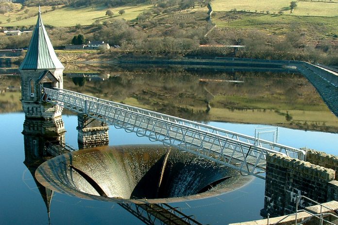
Welsh Water covers more than half of Wales and manages 136 drinking water catchments that feed 61 water treatment works and as such, its catchment spatial risk analyst play an important role in delivering potable water to over three million customers.
The catchment risk analysis team, which sits within the wider Water Services Science department, has traditionally relied on huge amounts of data from raw water sampling, along with spot samples and field observations.
However, in recent years, it has also gathered intelligence from farmers and landowners and earth observation to better understand the root causes of deteriorating or changing raw water quality.
The analyst was keen to demonstrate how a spatial and more collaborative approach to managing data from a variety of sources could transform their provision of scientific evidence and advice to the wider water services team.
Catchment spatial risk analyst Jamie Phillips said: “Water from catchment areas reaching our treatment works needs to be of manageable and expected quality. Where situations are often unpredictable, new means and ways of working with spatial data is critical for us in our work, so we can produce tailored web and mobile apps within hours.”
The solution
Esri’s ArcGIS has historically been used by Welsh Water primarily to consolidate its network and asset-related data.
The catchment spatial risk analysts identified that, as a system of engagement, the ArcGIS platform could also be used to share and manage data both internally and externally, allowing them to work more collaboratively with stakeholders right across catchments.
The team duly set to, building what they have christened the WaterSource Portal, utilising out-of-the box functionality with no additional software licensing costs. It collates, analyses, records and manages spatial data to identify and predict issues affecting raw water quality.
Trialled in late 2018, the portal was quickly adopted as a business-critical system. “The WaterSource Portal now acts as a one-stop shop for the whole team,” said Jamie. “It underpins much of our daily work, allowing us to create, use and share maps and apps not only with each other, but with external stakeholders too.
“Our original aim was to try to make complex data more easily accessible and understood. It has certainly done that.”
The integral Survey123 function helps the team to work off-line in often remote and isolated environments, aiding data capture and the identification of specific areas of water deterioration, for example where soil erosion has resulted in extra silt in rivers and reservoirs, thereby requiring more treatment.
Field data is now quickly visualised and summarised using the portal’s Operations Dashboard, in effect highlighting potential causes of water deterioration and providing the business intelligence the Water Services Science team needs to identify solutions for smarter catchment management.
As business demands evolve and conditions change, such as the impact of adverse weather conditions, the catchment team can tailor the collection and visualisation apps with speed and ease, thanks to the configurable templates in ArcGIS Enterprise.
Dr Phillippa Pearson, Head of Water Services Science at Welsh Water, said: “Encouraging innovation is extremely important to Welsh Water as it allows us to remain industry-leading and keeps us relevant in an ever-changing environment.
“The success of the WaterSource Portal demonstrates just how much people can achieve when given the time and flexibility to innovate and challenge the status quo.”
The solution supported Welsh Water’s business and environmental objectives by allowing it to work more collaboratively with external stakeholders, she added.
Sharing subjects of potential concern led to better land management and as water quality improved across the board, fewer chemicals were required, which in turn reduced operating costs while at the same time helping to safeguard the environment.
To find out how ArcGIS enables organisations to collaborate more effectively with stakeholders in the water industry, visit esriuk.com/water or contact Craig Hayes, head of Critical National Infrastructure at Esri UK on 01296 745599 or sales@esriuk.com


